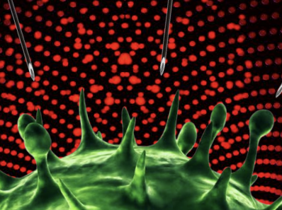
Les Arbres Boivent De L’eau Dans Les Roches
Science and Vie Magazine (Dec 2021)
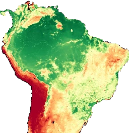
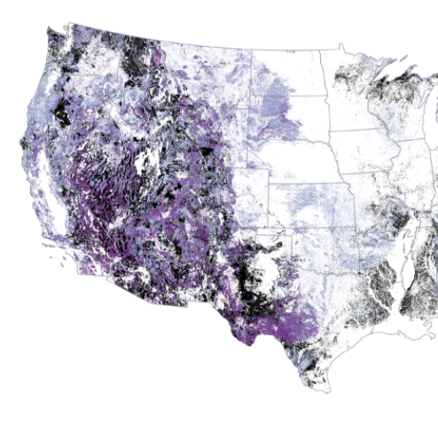
Extended information from McCormick et al., 2021 (Nature, 2021)
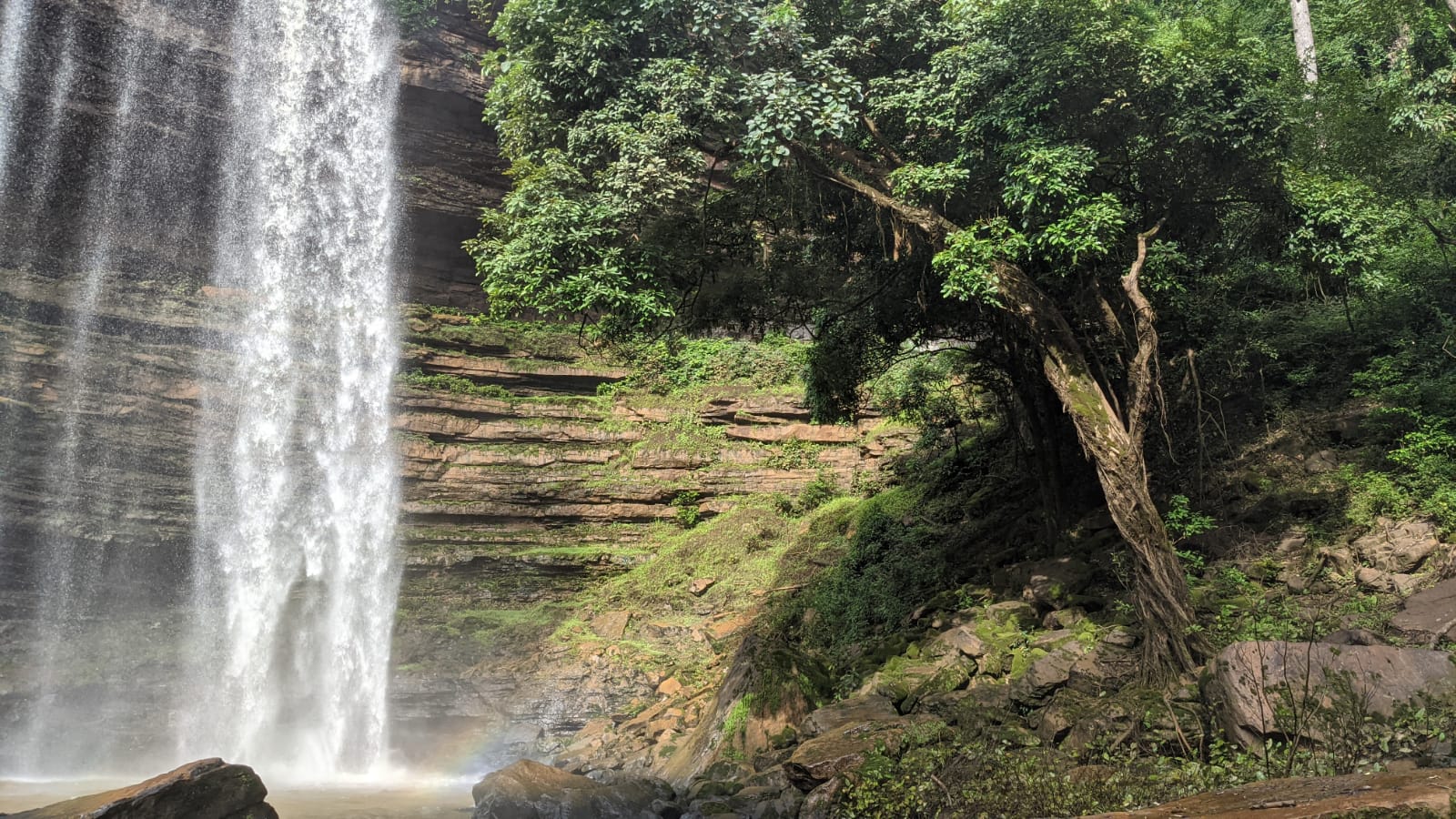
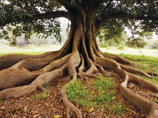
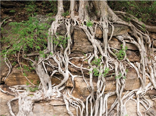
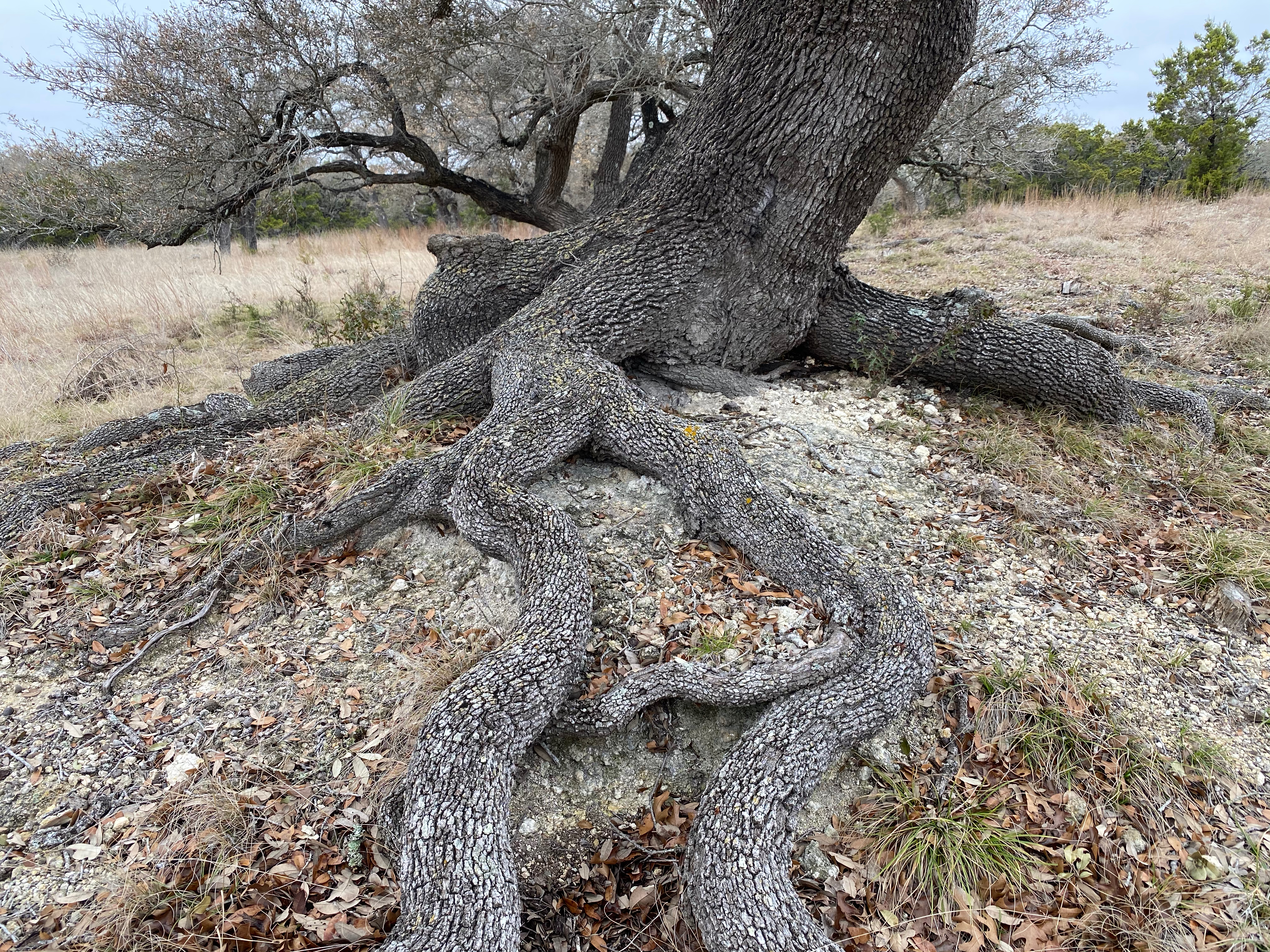
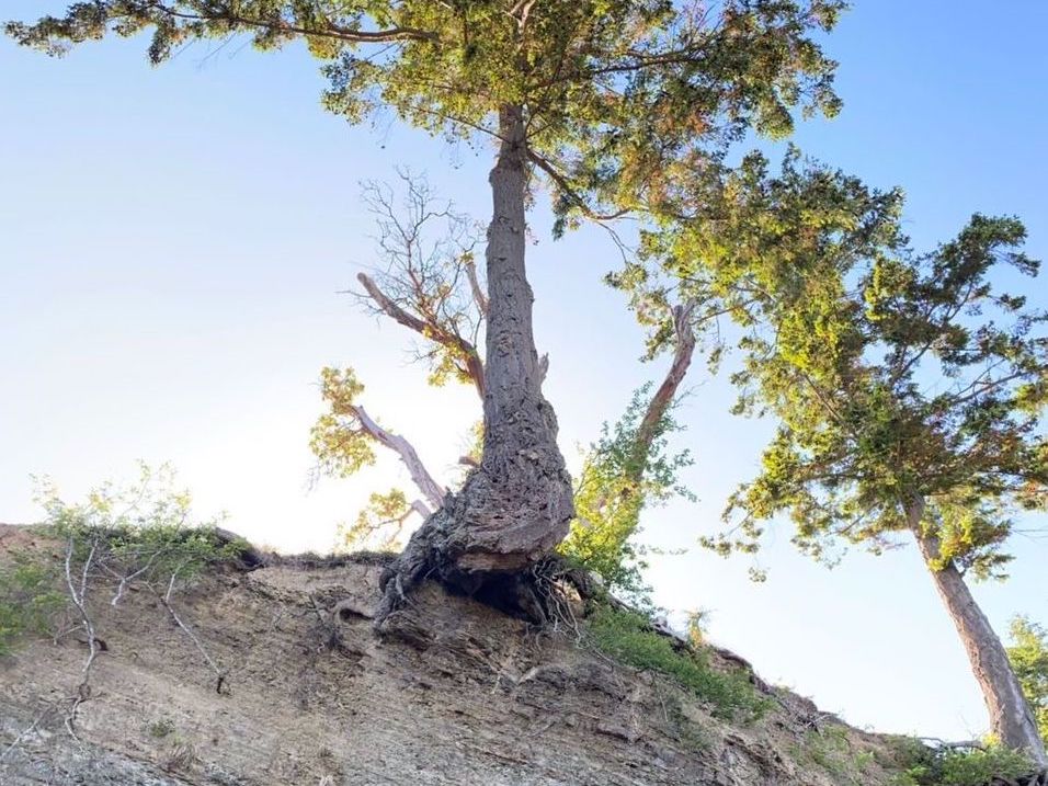
In the past several decades, field studies have shown that woody plants can access substantial volumes of water from the pores and fractures of bedrock. If, like soil moisture, bedrock water storage serves as an important source of plant-available water, then conceptual paradigms regarding water and carbon cycling may need to be revised to incorporate bedrock properties and processes. Here we present a lower-bound estimate of the contribution of bedrock water storage to transpiration across the continental United States (CONUS) using distributed, publicly available datasets. We find:
Click the icons to read more.
All of the code for this project is available on the GitHub repository and Zenodo.
All of the resulting data products from this project are available on Hydroshare. Relevant map data are also accessible via Google Earth Engine.
We used Google Earth Engine in the Google Colab Python API environment for the bulk of the analyses associated with this paper. This is a free service, however it requires users to sign-up prior to use.
Check out the paper (DOI 10.1038/s41586-021-03761-3) and press, including press releases from UT Austin and Simon Fraser University.
Science and Vie Magazine (Dec 2021)
Scientific American (Dec, 2021)
Eos (October 18, 2021)
University of Texas (September 8, 2021)
Simon Fraser University (September 8, 2021)
See above for more information on getting started with Google Earth Engine (GEE).
Penman-Monteith-Leuning Evapotranspiration V2 (PML_V2) (GitHub)(Zhang et al., 2019)500 m resolution. Available on GEE from 2002 to 2017. Bands used = 'Es' and 'Ec'.
PRISM Daily Spatial Climate Dataset
(Daly et al., 2007). 2.5 arc-minute resolution. Available on GEE from 1981 to 2021. Bands used = 'ppt.'
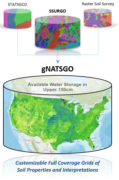
Gridded National Soil Survey Geographic Database (gNATSGO)
(Soil Survey Staff, 2019). Not available on GEE, but is hosted as a personal asset for this project, with relevant inputs also available as tifs in Hydroshare respository.
United States Geological Survey National Land Cover Database (USGS NLCD)
30 m resolution. Available on GEE from 1992 to 2017. Bands used: 'landcover'.
MODIS Terra Daily Global Snow Cover
500 m resolution. Available on GEE from 2000 to 2021. Bands used: 'NDSI_Snow_Cover.''
Datasets used in the analyses of bedrock water storage but not required for making or masking project products include: Koppen Climate (Peel et al., 2007)(data) ; MODIS Landcover (GEE), and above-ground Carbon (Spawn et al., 2020) (data) (personal GEE asset).
Please note: This is not a permanent repository. If these links cease to work, please find the same data, which can be added to GEE manually, stored permanently in the Hydroshare repository.
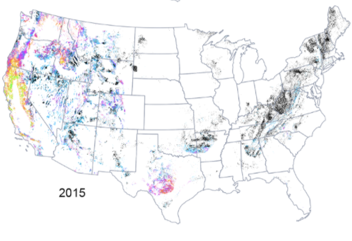
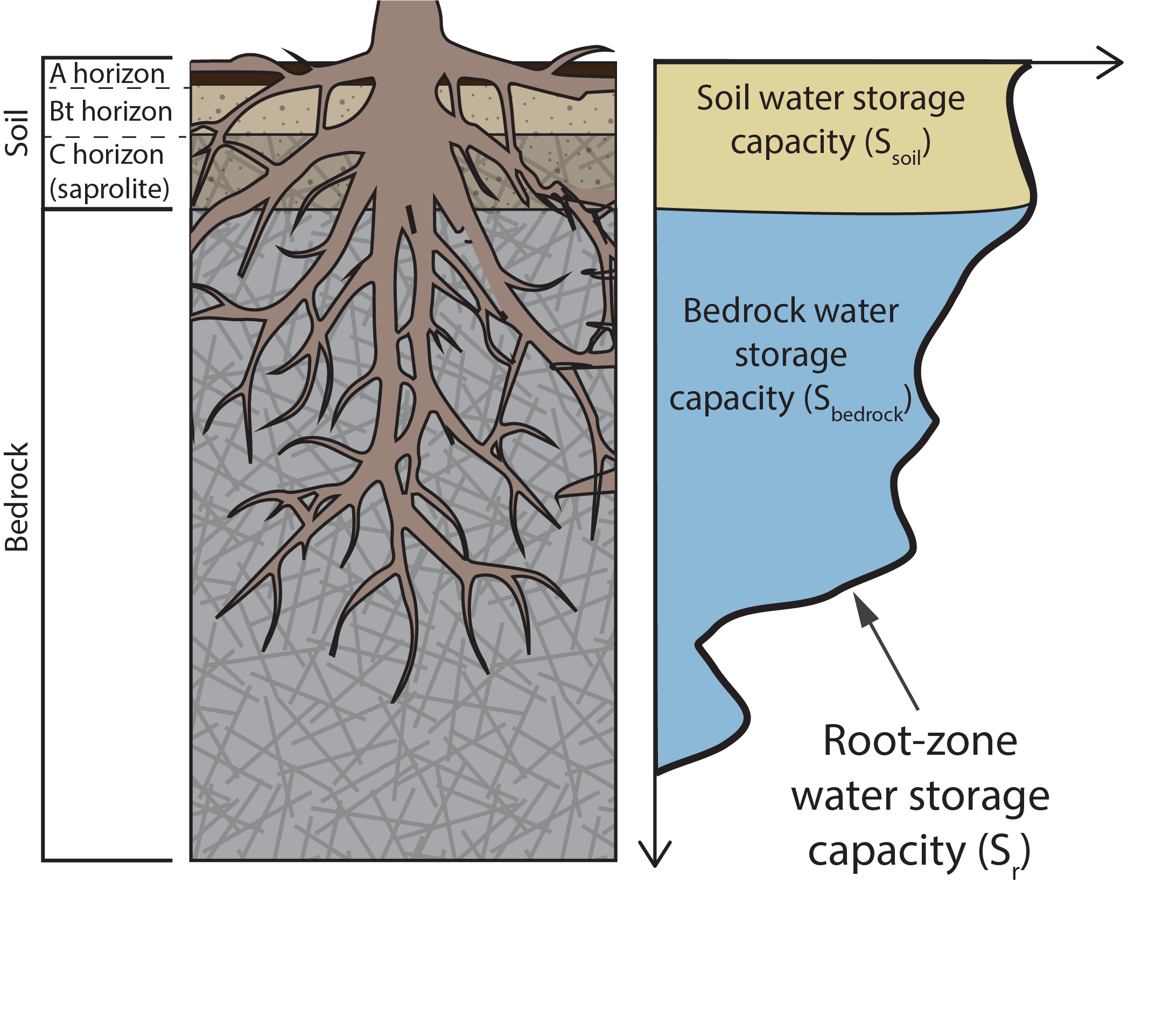
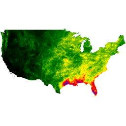
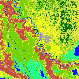
GEE collection with annual bedrock water storage capacities for water years 2003 to 2017, at 500 m resolution for CONUS and masked (see section on Masking Layers).GEE image of total bedrock water storage capacity (Sbedrock) calculated over the water years 2003 to 2017, at 500 m resolution for CONUS and masked (see section on Masking Layers).
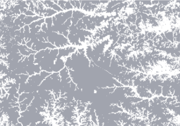
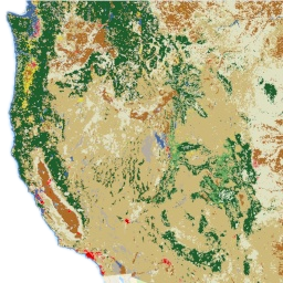
Three masks were used to restrict analyses to places likely to use bedrock water and GEE images are given in one GEE image collection, along with the combined total of the masks. These masks include: (1) Woody vegetation. (2) Depth to bedrock less than 1.5 m. (3) Cumulative evapotranspiration less than precipitation from 2003 to 2017. See the Methods section for more information on how these masks were created.
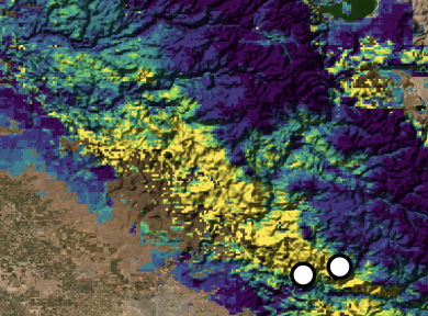
GEE image of Sr (mm) taken as the maximum root-zone storage deficit from 2003 to 2017. For more information, see the Methods section, as well as Dralle et al., 2020 , which details the snow correction method utilized for this product. The original inspiration was taken from Wang-Erlandsson et al., 2017, so you may also want to check that out!
Several other products were used in this study which, although published prior to this work, were not hosted on GEE and therefore were uploaded by the authors as personal assets for use in the code. Please see the above section in this site for links to those data and relevant personal GEE assets.